
Ride to Tortilla Flat
4/28/10
Ride to Tortilla Flat
4/28/10
The ride to Tortilla Flat and Canyon Lake is an absolute joy to take. We just did it about a month ago, and it was a little early for the wildflowers, but
they should really be starting to bloom by now. If you are looking for a ride with magnificent desert landscape packed with
centuries old Saguaro cactus nestled
in between the mountain backdrops, this
is the one for you. In my opinion, if that is your criteria, this is one of the most beautiful, curvy, and enjoyable rides
that you can take in the State topped off by an extraordinary view of Canyon Lake as you make your
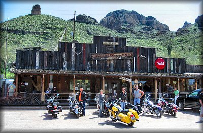
way to the old stopping point known as Tortilla Flat for lunch.
I have to remind you of what I consider to be the icing on what is already a great cake,
and that is to take the additional 6 miles of asphalt past Tortilla Flat. Most
riders have not done this section or have even heard of it. Because the road ends 6 miles to the North and turns
into gravel taking you to Roosevelt lake, no one thinks to take this section of the road. But I assure you, it
is well worth your effort to take this bonus road to the overlook point where it turns to gravel, and then come
back and enjoy it in the opposite direction. You WILL NOT be
disappointed. Some of the prettiest parts of the ride are back
there.
A route to get to Tortilla Flat that I like is to take Hwy 87 from Fountain Hills
North about 10 miles to the Bush Hwy., the turnoff to Saguaro Lake.
Take Bush 9 miles to Usery Pass, Turn left on Usery Pass 8 miles to Brown, left on Brown 6 miles to Hwy. 88,
which is also known as the Apache Trail. Take Hwy. 88 the 15 miles to Tortilla Flat and the other
6 miles past for the ultimate experience. On your way back, you can make a pit stop at the old Goldfield Ghosttown
for a quick sarsaparilla or ice cream while enjoying a walk around the old town.
I know over the years I have brought this to your attention several times, but even
as many times as I have done it, when someone mentions it to me, it reminds me how enjoyable it is, and it makes
me want to do it again. So grab a couple of friends this weekend and
head out there for lunch. Just be mindful to stay away from the center line as much as possible. This is also a
popular route for snowbirds and those pulling boats to the lake that often cross the center line. So be patient
and stay to the outside of the lane as much as possible.
I'm not sure how well the wildflowers are right now, we did it a month ago. But I am including some pics from last year about this time as well as some from
a month ago so that you can see the beauty of the area with flowers in bloom.
Click Here for Beautiful PHOTOS with wildflowers from 2009.
Click Here for 2010 Photos with photos of the extra 6 miles.
When you go to the photos page, click "Slideshow" in the upper right of the page. This will display them full screen and you can page through them there. This is the best way to view.
Click here to view
the MAP.
Enjoy your ride.
All information in this newsletter is
Copyright © 2010 BDC Products, LLC.
Information may be used only with permission.
All rights reserved.