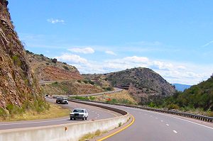
| This is an excellent ride that is a total of 174 miles. Even though this is a shorter ride, it is excellent. The ride up Hwy. 87 (Beeline) is a very
enjoyable route. The road conditions are excellent with mostly a divided 4 lane throughout the mountains up to
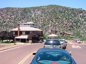
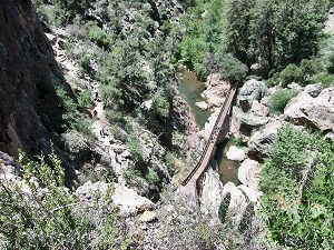
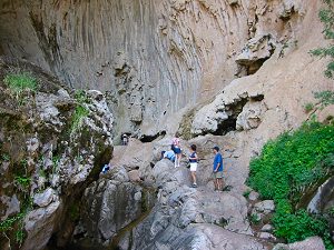
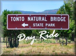
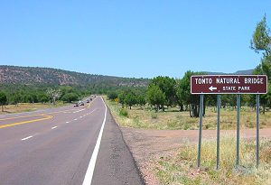
an elevation of 5000 ft. in Payson. Once you get to the Tonto Natural Bridge Park you can easily spend 2 hours
hiking along the creek or just sitting and enjoying the beautiful weather and the waterfalls. I have included below
a map of the route that we hiked. Temperatures will typically be about 10 -12 degrees cooler than the valley. Option 1: If you have time, you can extend the ride a little. When leaving Tonto Natural Bridge Park you can turn left and go another 4 miles North to Pine or another 3 miles past Pine to Strawberry. Very pretty little towns in the pine trees. Worth the short ride to see. |
|
Distance: 174 miles Roundtrip |
Riding Time: Approx. 3 hours |
|
|
Depending on where you leave from in the valley will affect the total mileage. |
||
|
Directions: |
||
 |
||
|
|
 |
|
|
|
|
|
 |
||
|
|
||
|
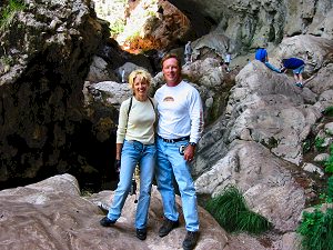
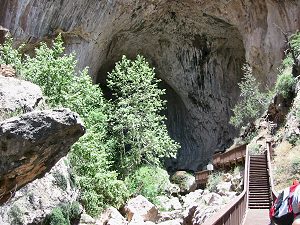
Scenes From Tonto Natural Bridge |
||
|
|
 |
|
 |
|
|
|
|
|
|
|
|
||
Click Here for a map of the park. |
||
| Option 1: When leaving Tonto Natural Bridge Park you can turn left and go another 4 miles North to Pine or another 3 miles past Pine to Strawberry. Very pretty little towns in the pine trees. Worth the short ride to see. | ||
|
My Review Of This Ride: Pros: Even though this is a shorter ride, it is excellent. The ride up Hwy. 87 (Beeline) is a very enjoyable route. The road conditions are excellent with mostly a divided 4 lane throughout the mountains up to an elevation of 5000 ft. in Payson. Once you get to the Tonto Natural Bridge Park you can easily spend 2 hours hiking along the creek or just sitting and enjoying the beautiful weather and the waterfalls. Temperatures will typically be about 10 -12 degrees cooler than the valley. The gift shop at the park has water and gatorade for refreshements. I would recommend taking a bottle with you on the hike. Cons: No cons on this one. It is the perfect ride. The only thing would be that it could be longer. But you can extend it by going on up to Pine and Strawberry. Conclusion: I give this ride 4.5 Spokes out of 5 |
||
| For more information on Tonto Natural Bridge State Park Click Here and for the State Park Site Click Here. | ||
|
Click
Here For A Complete Detailed Map |
||