|
Distance:
Varies from where you start in the Valley. It was 644 miles round trip
for us starting at Loop 101 and 75th Ave. Riding time is approximately 12 hours.
|
|
Directions:
Click Here For Travel Map
|
|
Story About Ride:
Click
Here For Story From Day 1
Click Here For Story From Day 2
|
|
Pictures:
|
|
Click Here For 100 Photos of The Ride
|
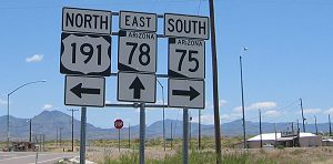
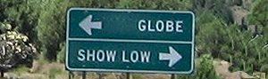
 Starting from Loop 101 and U.S. 60 take U.S. 60 East 75 miles to Globe.
 |
|
Day 1:
|
|
When you reach Globe you can take the turn at the sign that says Historic Downtown Globe if you would like to see
the old town of Globe. If you do this it is kind of tricky to get back on 60 if you don't know how. From the Main
St. of Globe turn left on Sycamore and then take the next right to 60 and turn left. |

|
| About
2 miles past the downtown area you will see some gas stations. That is a good place to get fuel. At about this
area you will see a sign telling you to go straight to 70 East to Safford. |
|
|
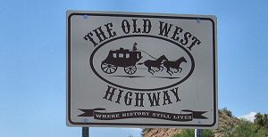
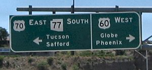
Continue on Hwy. 70 (The Old West Highway) through the San Carlos Apache Nation for 76 miles to Safford. This is
a good place to fuel up if you are running low because it is another 35 miles to the next fuel stop if it is open. |
|
| Continue
on through the City of Safford for another 10 miles to the Hwy. 191 North turnoff. Don't be confused by the Right
turn 191 turnoff in Safford by the Chevron Station. That is for South 191. |
|
| Continue
on Hwy. 191 North for 24 miles to a corner called 3 Way. You will see 2 small stores. One has gas, the other has
some food and drinks. |


|
| Turn
left to Hwy. 191 North at the 3 Way intersection. |
|
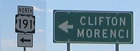
| You
are now 9 miles from Clifton where there is a nice public restroom in the old train station. Clifton is your last
"for sure" gas stop for about 90 miles to Alpine. If Hanagan Meadow station is open and has gas, that
is 66 miles away. |

|
| After
leaving Clifton going up the hill toward Morenci make sure that you follow Hwy. 191 North to Springerville. There
will be a fork in the road, stay to the right. |

|
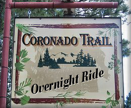
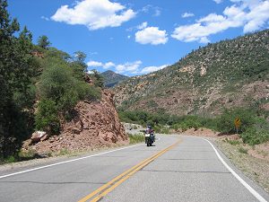
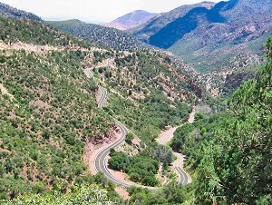
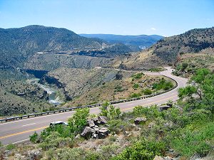
| You
are now on your way to experience the 300 twists and turns and the serene beauty of the Coronado Trail for the
next 66 miles to Hannagan Meadows where there is a lodge and a small country store to relax at after all of those
twists and turns. |

|
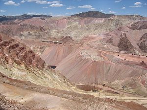
| Along
the way from Clifton to Hannagan Meadows you see the old mining town of Clifton. Click Here for a web site that
has some history
of Clifton. You will also go through the mining town of Morenci
that is basically owned by Phelps Dodge. You can stop at a viewing area just up the hill a couple of miles from
the town of Morenci to get a good view of the magnitude of the mining being done there. Click Here for some interesting
history of Morenci. |
| The
following are a few looks at what you will see along the way. |
|
|
|

|
|

|
|
|

|
|
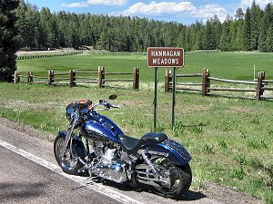
| You
have now climbed 6000 feet in elevation, traversed over 300 twists and turns and have arrived at Hannagan Meadows.
You can get some refreshments or just rest for a while on the porch of the Lodge. |
|
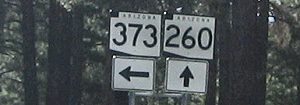
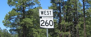
| You
will now be 22 miles from Alpine for fuel and food and 46 miles from the turnoff to Hwy. 260. The sign will point
you to Eagar to the left. This will take you to Greer. |

|
| From
the Eagar/260 turnoff you will go 13 miles through Eagar to Hwy. 373. Turn South on 373 to Greer. |
|
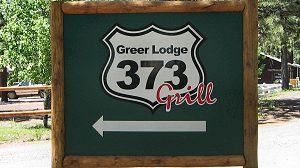
| When
you turn on Hwy 373 follow this 5.5 miles to the Greer Lodge for your overnight stay. |
|
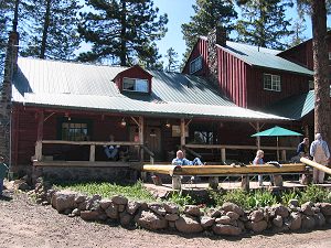
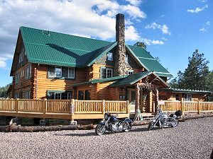
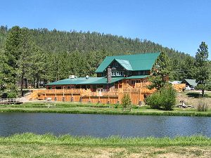
| The
Greer Lodge is my motorcycle friendly recommendation for the best place to stay in Greer. It is a beautiful Log
Cabin Lodge that has 11 rooms inside the Lodge and several cabins available that will sleep from 4 to 20 people.
The large back patio is perfect for an evening dinner while enjoying the awesome views of the mountains and the
Little Colorado River running below. You can contact the Greer Lodge at 928-735-7216 or at www.greerlodgeaz.com
. |
|
|

|
|
| Molly
Butler's is a good place to go for entertainment in the evenings. |
|
Day 2:
|
| Go
back to Hwy. 260 and turn left to continue on 260 West. |
|
| You
can continue on 260 West for 8 miles to Hwy. 273 and the big sign that will take you to Sunrise Park Resort. The
chair lift is running in the Summer. |

|
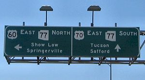
| Otherwise
you will travel 28 miles from Hwy. 373 through McNary to the Hwy. 73 turnoff at the Hon Dah Casino. |
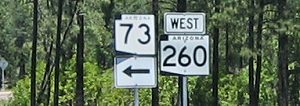
|
| Follow
Hwy. 73 another 49 miles to the intersection of Hwy. 60. Turn left towards Globe on Hwy. 60 West. |

|
| Follow
Hwy. 60 approximately 22 miles and you will see the beginnings of the beautiful Salt River Canyon. |
|
| Continue
on 60 through the Salt River Canyon another 42 miles to Globe where you will turn right to follow 60 West to Globe,
Superior and back to Phoenix where you started. |
|
|
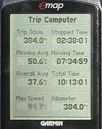
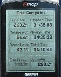
GPS Statistics:
Your distance will vary greatly depending on where you start
from. These numbers were logged from starting at 101 Loop and 75th Ave. in Northwest Glendale.
|
|
Day 1:
|
Day 2:
|
| |
|
Things To Know Before You Go
|
1. You will go through an extreme weather change as you make this trip.
You will go from 1200 feet in elevation here in Phoenix to over 9300 feet at the top of the trail. You will need
to layer appropriately.
2. It will take you 2-3 hours to ride the 60 miles from Clifton to Hannagan Meadows.
3. Watch for loose rocks and boulders in the roads.
4. Keep an eye on gas as there is not many stops for fuel on the Trail. |
|
Useful Links:
|
| http://www.byways.org/explore/byways/2059/stories/52884 |
|
My Review Of This Ride:
Pros: This is a fantastic ride. Lots of changes to tickle the senses and keep them wanting more.
Cons: I wish it was closer to Phoenix so that I could enjoy it more often.
Conclusion: I give this ride 5 spokes out of 5 for the awesome road, change in beautiful
scenery and the change in elevation.
|
|
Click Here For A Complete Detailed Map
|